
Using drones for timber surveys offers you fast, accurate data on forest health, tree height, and biomass. You can cover large areas quickly with multirotor or fixed-wing drones equipped with multispectral sensors or LiDAR. These tools help detect pests, estimate timber volume, and assess terrain features. Proper planning, maintenance, and understanding regulations guarantee reliable results. Stick around to discover more about how drone technology is transforming forestry management and conservation efforts.
Key Takeaways
- Drones equipped with multispectral sensors and LiDAR provide accurate measurements of tree height, biomass, and canopy health.
- Flight planning involves designing precise paths to efficiently cover large forest areas while avoiding obstacles.
- Drone data enables rapid assessment of timber volume, forest structure, and early detection of pests or disease.
- Proper system maintenance, software updates, and ground truthing ensure data reliability and survey accuracy.
- Regulatory compliance and battery limitations are key considerations for effective and legal drone timber surveys.

DJI P4 Multispectral Agriculture Drone, 3-Axis Stabilized Camera, RGB + 5 Multispectral Sensors, RTK Module, 27-Min Flight Time, 4.4-Mile Range
MULTISPECTRAL IMAGING: Advanced 6-camera array system featuring RGB camera for visible light plus 5 specialized cameras capturing multiple…
As an affiliate, we earn on qualifying purchases.
As an affiliate, we earn on qualifying purchases.
The Advantages of Drone Technology in Forestry

Drone technology offers significant advantages in forestry by providing accurate, real-time data that traditional methods often can’t match. With drones, you can monitor forest health more efficiently, spotting signs of disease, pest infestations, or damage early before they spread. This proactive approach helps you manage forests sustainably and protect biodiversity. Additionally, drones minimize wildlife disturbance compared to ground surveys or manned aircraft, reducing stress on animals during assessments. Their aerial perspective allows you to cover large areas quickly, saving time and resources. You can identify areas needing attention without intrusive methods, maintaining a balanced ecosystem. Overall, drone technology enhances your ability to make informed decisions, ensuring healthier forests and less disruption to wildlife.
LiDAR drone for timber assessment
As an affiliate, we earn on qualifying purchases.
As an affiliate, we earn on qualifying purchases.
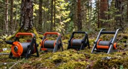
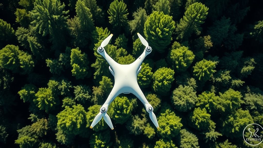
Types of Drones Used in Timber Surveys

Various types of drones are employed in timber surveys, each designed to suit specific forestry needs. Multirotor drones are popular for their agility and ability to hover, making them ideal for detailed inspections and mapping small areas. Fixed-wing drones cover larger terrain quickly, perfect for extensive forest assessments. Some drones come equipped with multispectral sensors to analyze tree health and biomass. When choosing a drone, you must consider drone maintenance to ensure reliable operation and safety. Additionally, legal regulations govern drone use, requiring proper licensing and adherence to airspace rules. Understanding these drone types helps you select the right equipment for efficient timber surveys, saving time and increasing accuracy while staying compliant with all legal requirements. To ensure safe and effective operation, it’s also important to stay informed about drone regulations and updates in airspace policies. Proper training and ongoing education can help operators navigate airspace rules effectively and avoid violations. Staying current with regulatory changes can prevent costly penalties and ensure your survey operations remain lawful. Being aware of drone maintenance best practices can further enhance the longevity and performance of your equipment. Additionally, selecting drones with longer battery life can significantly improve operational efficiency during extended surveys.
fixed-wing drone for large area forest mapping
As an affiliate, we earn on qualifying purchases.
As an affiliate, we earn on qualifying purchases.
The Process of Conducting a Drone-Based Timber Survey

To conduct a drone-based timber survey, you start by planning effective flight paths to cover the area thoroughly. Next, you capture high-quality aerial data using your drone’s sensors and cameras. Signs of spoilage and other factors can affect the accuracy of your data, so careful preparation is essential. Additionally, understanding airless spray technology can help in optimizing flight stability and data accuracy during the survey, especially in varying wind and wave conditions. Incorporating knowledge of industry transformations can also provide insights into emerging tools and techniques that enhance survey effectiveness. Finally, you analyze the collected data to measure timber volume, health, and other important metrics. Incorporating knowledge of wave and wind conditions can help optimize flight stability and data accuracy during the survey.
Planning Flight Paths
Planning flight paths is a critical step in conducting an effective drone-based timber survey. Proper planning guarantees you maximize coverage while maintaining safety. Focus on flight path optimization to cover the entire area efficiently, reducing flight time and battery use. Consider obstacle avoidance by mapping out potential hazards like trees, power lines, or terrain features. Use software tools to design precise paths that navigate around obstacles smoothly. To streamline your process, create a table like this:
| Area Section | Flight Path Strategy | Obstacle Consideration |
|---|---|---|
| North Zone | Grid pattern | Trees, power lines |
| South Zone | Spiral pattern | Hills, dense foliage |
| Central Zone | Linear routes | Large, scattered trees |
This approach helps you execute a safe, thorough timber survey with minimal risk and maximum data quality. Incorporating advanced planning techniques can further enhance the accuracy and safety of your drone flights, especially when accounting for environmental obstacles that may affect flight safety. Additionally, understanding flight path optimization can significantly improve data collection efficiency and reduce operational costs.
Capturing Aerial Data
Once your flight paths are set, the next step is to begin capturing the aerial data needed for an all-encompassing timber survey. As your drone flies along the planned routes, it records detailed images and multispectral data of the forest. This data helps identify different tree species by analyzing their unique spectral signatures. Additionally, you can detect early signs of pest infestation, such as discolored or dying foliage, which are visible in high-resolution images. Make sure to fly at appropriate altitudes to maximize image clarity and coverage. Properly capturing this data is vital for accurate analysis later. Incorporating specialized sensors can enhance the detection of specific tree health indicators. Also, understanding field recording techniques can improve the quality of the captured audio data if audio analysis is part of your monitoring process. Employing advanced data processing techniques can further improve the accuracy of your assessments. Moreover, utilizing machine learning algorithms can automate and refine the interpretation of complex data sets. A thorough understanding of remote sensing technology can also significantly improve the overall effectiveness of your survey. With precise imagery, you’ll gather the essential information needed to assess forest health, species distribution, and potential pest issues efficiently and effectively.
Analyzing Timber Metrics
How do you transform raw aerial data into meaningful timber metrics? First, verify your drone is properly calibrated to capture accurate measurements. Drone calibration involves checking sensors and cameras to prevent data distortion. Once you’ve collected high-quality images, process them with specialized software to analyze tree heights, canopy cover, and stand volume. Managing your drone’s battery is vital—plan flights efficiently to maximize data collection without power loss. Accurate calibration reduces errors, while good battery management ensures you gather extensive data in each flight. Additionally, implementing proper maintenance routines helps prevent sensor drift and system malfunctions. Regular software updates are essential to keep your processing tools functioning optimally and secure against vulnerabilities. To enhance data accuracy, consider employing ground truthing methods to validate drone-derived metrics. Incorporating data validation techniques can further improve the reliability of your assessments. After processing, compare the metrics with existing data to evaluate forest health or timber volume. Proper drone maintenance is essential to ensure consistent data quality throughout your survey. This systematic approach turns raw images into actionable insights, enabling precise timber assessments and better forest management decisions.
multirotor drone for tree health inspection
As an affiliate, we earn on qualifying purchases.
As an affiliate, we earn on qualifying purchases.
Key Data Collected Through Aerial Surveys

When you conduct aerial surveys, you’ll gather essential data like tree canopy measurements and terrain topography. These details help you assess forest health and plan harvesting operations more effectively. Understanding this key information enables you to make informed decisions for sustainable forest management.
Tree Canopy Measurements
Have you ever wondered how aerial surveys accurately measure tree canopies? Drones use high-resolution cameras and LiDAR sensors to gather detailed data. They analyze the images and point clouds to determine:
- Tree height by measuring the distance from the ground to the top of the canopy
- Leaf density through analyzing canopy cover and foliage thickness
- The overall shape and volume of the canopy for better understanding of forest structure
This data helps you assess forest health, growth patterns, and timber volume. By capturing precise measurements of tree height and leaf density, drones provide a clear picture of canopy density and distribution. These insights are essential for sustainable forest management and planning, making aerial surveys an invaluable tool in modern forestry.
Terrain Topography Mapping
Aerial surveys equipped with drones efficiently capture detailed terrain topography, providing critical data for forest management and land planning. This data helps you comprehend the landscape’s shape, elevation, and slopes, essential for evaluating forest ecology and planning sustainable timber harvesting. Using high-resolution imaging and LiDAR sensors, your drone collects precise topographical maps that reveal subtle land features often missed on ground surveys. Regular drone maintenance ensures consistent data quality and prolongs equipment lifespan, preventing costly downtime. Accurate terrain maps enable you to identify erosion-prone areas, water flow patterns, and suitable planting zones. This thorough topographical understanding enhances decision-making, promotes ecological health, and optimizes forest utilization while minimizing environmental impact.
Challenges and Limitations of Using Drones in Forestry

Despite their many advantages, using drones in forestry presents several challenges and limitations that can hinder their effectiveness. Regulatory hurdles often restrict where and how you can operate drones, requiring permits and adherence to strict rules that slow down projects. Limited battery life is another significant issue, forcing you to plan flights carefully and frequently recharge or swap batteries, which can delay data collection. Additionally, dense canopy cover can obstruct drone visibility and data accuracy.
Drones face regulatory, battery, and canopy challenges that can limit forestry survey efficiency.
- Navigating complex regulations can be time-consuming and costly
- Short flight times restrict extensive surveys in a single session
- Thick foliage hampers clear imaging and data accuracy
These limitations demand careful planning and may reduce the efficiency and scope of drone-based forestry surveys.
Future Trends and Innovations in Drone Forestry Applications

Advancements in drone technology are paving the way for more efficient and accurate forestry surveys, addressing many of the limitations faced today. Automated drone maintenance reduces downtime and guarantees continuous operation, making large-scale surveys more feasible. AI-driven data processing accelerates analysis, providing real-time insights into forest health, biomass, and tree species. Future innovations will likely include smarter obstacle avoidance, enhanced battery life, and autonomous flight capabilities, allowing you to cover vast areas with minimal human intervention. These developments will streamline data collection, improve accuracy, and lower costs. As these technologies mature, your ability to monitor forests sustainably and respond swiftly to environmental changes will considerably improve, transforming the future of forestry management.
Frequently Asked Questions
What Are the Legal Regulations for Drone Use in Forestry Areas?
You need to understand the legal regulations for drone use in forestry areas to guarantee legal compliance. Regulatory frameworks vary by country and region, often requiring you to register your drone, obtain permits, and follow specific flight restrictions. Always check local laws before flying, stay within permitted areas, and respect privacy laws. Following these guidelines helps you operate safely and legally, avoiding penalties and supporting responsible drone usage in forestry environments.
How Do Drone Surveys Compare Cost-Wise to Traditional Methods?
While traditional methods often involve extensive manpower and equipment, drone surveys offer impressive cost efficiency. You’ll find that initial equipment costs are higher, but savings quickly add up with reduced labor and faster data collection. Drones streamline the process, cutting down on surveying time and labor expenses, making them a smarter investment for long-term efficiency. Overall, drones provide a more cost-effective solution compared to conventional timber survey techniques.
Can Drones Operate in All Weather Conditions for Timber Surveys?
You wonder if drones can operate in all weather conditions for timber surveys. Weather limitations and drone durability are key factors. Generally, drones struggle in heavy rain, strong winds, or extreme cold, which can damage or hinder their performance. While some drones are designed with weather resistance, their durability varies. Always check your drone’s specifications to guarantee it can handle specific weather conditions, but don’t rely on it in severe weather.
What Training Is Required for Drone Operators in Forestry?
Ever wondered what it takes to pilot a drone in forestry? You’ll need proper training, including drone certification and remote piloting skills. This guarantees you operate safely and legally while gathering accurate timber data. You’ll learn about navigation, safety protocols, and regulations. With the right training, you’ll confidently manage drone operations in various environments, making your forestry surveys efficient and compliant. Isn’t it exciting to master cutting-edge technology for sustainable forestry?
How Secure Is the Data Collected During Drone Surveys?
You should know that the data collected during drone surveys is generally secure if proper measures are in place. Using data encryption helps safeguard your information from unauthorized access. However, risks remain if security protocols aren’t followed or if unauthorized access occurs. To ensure security, it’s essential to implement strong encryption methods, limit access to authorized personnel, and regularly monitor your systems for any vulnerabilities.
Conclusion
Imagine you’re guiding a bird soaring over dense forests, effortlessly capturing every detail below. Drones make this possible, turning complex timber surveys into precise, efficient missions. With advancements in drone tech, you can now gather vital data faster and safer than ever before. Just like that bird, you gain a clearer view—helping you make smarter forestry decisions. Embrace drone technology, and watch your timber management soar to new heights.